| Contact Us | Site Guide | Search |
Image Credits | ||
Title/Person/Event |
Description |
Repository/Owner |
| Acoma Rock, New Mexico | (1) Acoma Rock and Zuni Pueblo, view from distance, color photograph, ca. 2000 (2) roadway on Acoma Rock with Acoma Indian women carrying pottery vessels; black-and-white photograph by Edward S. Curtis, 1905 (3) view from north showing waterhole; black-and-white photograph by M. James Slack, 17 April 1934 |
Courtesy of the New Mexico Department of Tourism Courtesy of the Library of Congress, Edward S. Curtis Collection, #LC-USZ62-69898 Courtesy of the Library of Congress, Historic American Buildings Survey, #HABS NM,31-ACOMP,1-6 |
| Alabama: Tallapoosa River | color photograph, n.d. |
Courtesy of the U.S. Department of Agriculture, Natural Resources Conservation Service, Alabama Section |
| Albany, New York, structures | (1) Dutch Reformed church, late 1600s, drawing (2) Schuyler House, later known as Staats House, built between 1659 and 1667, drawing |
New York State Museum, in online exhibition The People of Colonial Albany Live Here. Permission pending. |
| Albany, New York, town and fort, 1695 | illustrations in John Miller, A description of the province and city of New York, with plans of the city and several forts as they existed in the year 1695, 1843 |
Reproduced by permission of the New York Public Library, Lionel Pincus and Princess Firyal Map Division, Digital IDs #434581 (town) & #434569 (fort) |
| An Aleut in his baidarka, 1744 | drawing on the chart of the voyage of the St. Peter, (Bering expedition) by Sven Waxel and Sofron Khitrov, 1744, in the Archives of the Hydrographic Section of the Ministry of Marine, St. Petersburg, Russia |
Reproduced by permission of the American Antiquarian Society, Worcester, Massachusetts |
| Aleutian Islander wearing an "eye shade," ca. 1784 | copper engraving by W. Sharp (from drawing by J. Webber), published in James Cook, A Voyage to the Pacific Ocean, London, 1784 |
Courtesy of Library and Archives Canada (Bibliothèque et Archives Canada), Canadiana #915611775, in online collection Early Images of Canada: Images from Rare Books |
| Alsop, George, 1666 | portrait in Alsop, A Character of the Province of Mary-Land, 1666 |
Reproduced by permission of the New York Public Library, Miriam and Ira D. Wallach Division of Art, Digital ID #498424, in online collection The New York Public Library Digital Gallery |
| Alutiiq sod house village, Afognak Island [Alaska], archaeological excavation of, 1996 | color photograph by Patrick Saltonstall |
Reproduced by permission of Patrick Saltonstall, Alutiiq Museum & Archaeological Repository, Kodiak, Alaska |
| An American [Indian] from Virginia, 1645 | etching entitled Unus Americanus ex Virginia by Wenceslaus Hollar, Antwerp |
Courtesy of the Library of Congress, Prints & Photographs Division, #LC-USZC4-4603 |
| Amphibolite, metamorphic rock | rock sent as "gold" to England by Frobisher's ore mining venture on Baffin Island, 1578 |
Reproduced by permission of the Lapworth Museum of Geology, University of Birmingham (UK) |
| Andros, Edmond | portrait; engraving labeled "Sir Edmund Andros, Kent," n.d. |
Reproduced by permission of the New York Public Library, Print Collection, Digital ID #420869 |
| L'Anse aux Meadows, Newfoundland | color photograph of shore and grasses, by P. Harboldt, National Museum of Natural History, Smithsonian Institution. n.d. (ca. 2000) |
Courtesy of the National Museum of Natural History, Smithsonian Institution, in online exhibition Vikings: The North Atlantic Saga |
| Arkansas | color photographs, n.d. (1) White Rock Mountain, Ozarks National Forest (2) Deer in Timberlands region |
Courtesy of Arkansas Parks and Tourism
|
| Athore shows Laudonnière the Marker Column set up by Ribault; see Le Moyne de Morgues, Jacques | ||
| Attwater Prairie Chicken National Wildlife Refuge, Texas | color photograph by Paul Mitchum, 4 December 2005; copyright Paul Mitchum |
Reproduced by permission of Paul Mitchum |
| Aztec; see Mexica | ||
| Bacon, Nathaniel | portrait; engraving by T. Chambars, between 1760 and 1800, "after an original at Lord Viscount Grimston's at Gorhambury" by Seipse |
Courtesy of the Library of Congress, Prints & Photographs Division, #LC-USZ62-91133 |
| Bacon, Nathaniel; memorial plaque, ca. 1939 | black-and-white photograph of plaque in rotunda of the Capitol in Richmond, Virginia; taken for bound volume of photographs displayed in the Virginia Room Exhibit at the 1939 World's Fair |
Reproduced by permission of the Library of Virginia, #001110210 |
| "Bacon's Castle," home of Arthur Allen, Surry County, Virginia, constructed 1660s | black-and-white photographs, exterior views, ca. 1930s |
Courtesy of the Library of Congress, Historic American Buildings Survey, #HABS VA, 91-____, 1-4 & 1-7 |
| "Bacon's Epitaph, made by his man," poem, ca. 1676 | image of first page of handwritten poem; author unknown |
Reproduced by permission of the Virginia Historical Society |
| "Bacon's Epitaph, made by his man," poem, ca. 1676 | image of first page of handwritten poem; author unknown |
Reproduced by permission of the Virginia Historical Society |
| Bald eagle, beaver, early 1700s | separate colored prints by Jan Velten, from album known as Book of Blauw Jan, also called Wonders of Nature and Album by Jan Velten. The drawings show an American bald eagle and a beaver that in all possibility came, stuffed or not, from New Netherland. They were shown in the menagerie of the Amsterdam Blauw Jan (Blue Jan) Inn. |
Courtesy of the Library of Congress and the National Library of The Netherlands (Repository: Plantage Library, Library of the University of Amsterdam), #ISBN 35401 (eagle) & #ISBN 3540146628 (beaver), in online exhibition The Atlantic World: America and the Netherlands / De Atlantische Wereld: Amerika en Nederland. |
| Baltimore, Lord (Cecil Calvert) | full-length color portrait by Gerard Soest, n.d. |
Enoch Free Pratt Library, Baltimore, Maryland. Permission pending. |
| Baltimore, Lord (Cecil Calvert), coat of arms | 17th century; published in The Calvert Papers, no. 1, Maryland Historical Society, Baltimore (J. Murphy & Co., printers), 1889-99 |
Courtesy of the Library of Congress, General Collections (or Rare Book & Special Collections) Division, #F176 .M37 NO. 28, 34, 35, in online collection The Capital and the Bay: Narratives of Washington and the Chesapeake Bay Region, ca. 1600-1925 |
| Barbados, plantations and cemetery, mid 1600s | color photographs and drawing from the personal collection of Jerome S. Handler (1) Nicholas Abbey plantation house, 1650s; photograph, 1985 (2) Drax Hall plantation yard, 1650s; aerial photograph by Frederick Lange, ca. 1971 (3) Drax Hall plantation house, with front entrance at left, photograph, 1972 (4) Ashford, the estate of Henry Hart, drawing from mid 19th century (5) skeleton, Newton plantation cemetery, perhaps of an "Obeah man," photograph (6) brass bracelet, Newton plantation cemetery, photograph (7) coiled copper bracelet, Newton plantation cemetery, photograph |
Courtesy of Jerome S. Handler, Michael L. Tuite Jr., and the University of Virginia Library, in online collection The Atlantic Slave Trade and Slave Life in the Americas: A Visual Record #NW0082 #NW0083 #NW0084 #NW0012 #B72_extended #B72_flanged_bracelet #B72_coiled bracelet |
| Barbados, waterfront view of Bridgetown, 1695 | etching by Samuel Copen entitled A prospect of Bridge Town in Barbados |
Courtesy of the Library of Congress, Prints & Photographs Division, #LC-USZ62-124469 |
| Barclay, Alexander; see The Ship of Fools |
||
| Beads, porcelain ("wampum") used by the Iroquois, 1722 | copper engraving in Claude-Charles Bacqueville de La Potherie, Histoire de l'Amérique septentrionale, 1722 |
Courtesy of Library and Archives Canada (Bibliothèque et Archives Canada), Canadiana #905622782 |
| Beads, Venetian glass; see Jamestown archaeological excavation and artifacts |
||
| Beaver, Dutch drawing; see Bald eagle, beaver, early 1700s |
||
| "A Beaver 26 inches long from the head to the tail," New France, 1703 | illustration as captioned in frontispiece of Louis Armand de Lom d'Arce, Baron de Lahontan, Nouveaux voyages dans l'Amérique septentrionale (New Voyages to North-America), 1703 |
Digital image by the National Humanities Center from the 1905 reprint of Nouveaux voyages, ed. Rueben Gold Thwaites, Chicago: McClurg & Co. |
| Belle, excavated hull, ca. 1997 | color photograph of the exposed hull of La Salle's ship after excavation from Matagorda Bay, Texas, 1997 |
Reproduced by permission of the Texas Historical Commission; digital image from University of Texas-Austin, in online presentation Texas Beyond History |
| Beothuk village, Newfoundland, ca. 1773 | drawing in map by John Cartwright, A Sketch of The River Exploits and The East End of Lieutenant's Lake in Newfoundland, ca. 1773 |
Courtesy of the Provincial Archives of Newfoundland and Labrador (The Rooms), St. John's, Newfoundland, Canada, #PANL MG-100 |
| Berkeley, William | (1) portrait: oil by Harriotte L. T. Montague, n.d., after original by Sir Peter Lely (2) portrait: mezzotint, n.d. |
Reproduced by permission of the Library of Virginia Reproduced by permission of the New York Public Library, Digital ID #478850 |
| Boston uprising of 1689, broadside | "At the town-house in Boston: April 18th, 1689. [A letter] To Sir Edmond Andros Knight . . . [concerning his surrender]; signed by Wait Winthrop and others" |
Courtesy of the Library of Congress, Rare Book & Special Collections Division, Printed Ephemera Collection, #Portfolio 33, Folder 17 |
| Bradstreet, Simon | portrait; lithograph by Francis D'Avignon, 19th century |
Reproduced by permission of the New York Public Library, Digital ID #420662 |
| Brébeuf, Jean de, S.J., 1664 | portrait; engraving based on the composite picture engraved by Grégoire Huret and published in 1664 in the Historia Canadensis of Father François de Creux |
Courtesy of Library and Archives Canada (Bibliothèque & Archives Canada), copy negative #C-001191 |
| A Brief History of the War with the Indians in New England, by Increase Mather, 1676, title page |
American Antiquarian Society. Permission pending. | |
| Buffalo, 1635 |
woodcut captioned "Taurus quivirensis" in Juan Nieremberg (Spanish Jesuit in Mexico), Historia Naturae, Maxime Peregrinae . . . (A Natural History of the Americas), 1635 | Reproduced by permission of the John Carter Brown Library, Brown University, #0379-22, in online collection Archive of Early American Images |
| Caddo (Ceni) settlement, Texas, ca. 1691-1692 |
drawing/map of Upper Nasoni settlement on the Red River, by a member of the Spanish expedition of 1691-1692 to Tejas (Texas); original (uncolored) map in the Archivo General de Indias, Seville, Spain |
Digital image reproduced by permission of the University of Texas-Austin, Texas Archaeological Research Laboratory, in online exhibition Texas Beyond History |
| Caribbean islands named by Columbus, 1493 |
engraving cited in collection as "Columbus arrives in the New World," in Epistola de insulis nuper inventis / De insulis inuentis: Epistola Cristoferi Colom, published by J. Wolff, Basel, 1493 |
Reproduced by permission of the John Carter Brown Library, Brown University, #06202-1 |
| Cartier, Jacques, ca. 1675 |
drawing by Louis Nicolas, ca. 1675, in Les Raretés des Indiens (Codex canadiensis), ca. 1700 |
Reproduced by permission of the Gilcrease Museum, Tulsa, Oklahoma |
| Cathedral of Santa Maria le Menor, Santo Domingo, Dominican Republic |
color photograph of interior, ca. 2003, by Robert Kitay |
Robert Kitay, on website Pbase.com. Permission pending. |
| Charlevoix, Pierre-François-Xavier |
portrait; engraving, n.d. |
Reproduced by permission of the New York Public Library, Print Collection, Digital ID #1211745 |
| Chilam Balam of Chumayel, illustration of the names and symbols of gods |
illustration in Ralph L. Roys, ed., trans., The Book of Chilam Balam of Chumayel, Carnegie Institution of Washington [DC], 1933, text-figure 25, p. 113 |
Reproduced by permission of the Carnegie Institution, Washington, DC |
| Codex Canadiensis; see Nicolas, Louis |
||
| Codex Magliabecchi, ca. 1530, illustrations |
(1) Quetzalcoatl, p. 50 (2) ritual human sacrifice, p. 58 (3) memorial service in honor of a dead chieftain, p. 60 |
Reproduced by permission of the University of Utah, J. Willard Marriott Library, Rare Books Division, Special Collections, in online collection Mesoamerican Manuscript Facsimiles |
| Columbus, Christopher |
(1) portrait; black-and-white photograph, 1903, of watercolor facsimile after a painting by an unknown artist in the Museo Naval, Madrid (2) armor of Columbus, in America de Madrid, photograph by J. Laurent between 1860 and 1880 |
Courtesy of the Library of Congress, Prints & Photographs Division portrait: #LC-USZ62-103591 armor: #LC-USZ62-108633 |
| Copper Canyon, Chihuahua, Mexico; and Turahumara Indians |
(1) color photographs by Randy R. Johnson, 2006 -Copper Canyon, view -Turahumara settlement (2) color photographs (two) of a Turahumara man, 2001, by Geri Anderson (3) color photograph of the Jesuit mission of Satevo, 2006, by Paul & Casey Thomas |
Reproduced by permission of Randy R. Johnson Reproduced by permission of Geri Anderson, on MexConnect Reproduced by permission of Paul & Casey Thomas, on Travelblog.org, photo #230109 |
| de Bry, Theodore (and sons); see title/description of engraving, or de Bry below |
||
| de Bry, Theodore, engravings in Girolamo Benzoni, Historia del mondo nuovo (History of the new world), 1595 |
hand-colored engravings created and published by Theodore de Bry as part of series Grands Voyages, V. II, America, Pt. 5, Frankfurt, 1595 (1) African slaves pour ore at the mines of the Spanish Caribbean, entitled Nigritae in scrutandis venis metallicis ab Hispanis in Insulas ablegantur (2) African slaves process sugar cane in the Caribbean, entitled Nigritae exhaustis venis metallicis consiciendo saccharo operam dare debent |
Reproduced by permission of the John Carter Brown Library, Brown University #34724-2 #34724-3 |
| de Bry, Theodore, engravings and title page in Thomas Harriot, A brief and true report of the new found land of Virginia, 1590 |
title page and fourteen engravings of the Algonquian Indians of "Virginia" (area of Roanoke Island and Pamlico Sound of present-day North Carolina), created by Theodore de Bry (based on the watercolors of John White); published by de Bry as part of series Grands Voyages, V. II, America, Pt. 1, Frankfurt, 1590 |
Courtesy of The University of North Carolina at Chapel Hill Library, in online collection Documenting the American South |
| de Bry, Theodore, engravings in Jacques Le Moyne de Morgues, Brevis narratio eorum quæ in Florida Americæ provincia Gallis acciderunt (A brief narration of those things which befell the French in the province of Florida in America), 1591 |
engravings depicting the French 1564 expedition, Fort Caroline, and the Timucuan Indians of Florida, created by Theodore de Bry (based on watercolors by Le Moyne); published by Theodore de Bry as part of series Grands Voyages, V. II, America, Pt. 2, Frankfurt, 1591 |
Courtesy of The Florida Center for Instructional Technology, University of South Florida |
| de Bry, Theodore, construction of Fort Caroline, engraving in Jacques Le Moyne de Morgues, Brevis narratio, 1591 [see entry above] |
hand-colored engraving by Theodore de Bry based on watercolor by Le Moyne; published by Theodore de Bry as part of series Grands Voyages, V. II, America, Pt. 2, Frankfurt, 1591 |
Reproduced by permission of the John Carter Brown Library, Brown University, #08915-14 |
| de Bry, Theodore, engravings in Bartolomé de las Casas, Narratio regionum indicarum per Hispanos (A Short Account of the Destruction of the Indies), written 1542, orig. publ. 1552, de Bry publ. 1598 |
title page and four untitled engravings created and published by Theodore de Bry |
Reproduced by permission of the John Carter Brown Library, Brown University, #0683-1, 0683-2, 0683-4, 0683-7, 0683-10 |
| de Bry, Theodore (or family of), engravings in J. L. Gottfriedt, Newe Welt vnd americanische Historien, 2d. ed., 1655 |
engravings made by Theodore de Bry (1528-1598), his sons Johann Israel de Bry (died 1611) and Johann Theodor de Bry (1561-1623?), and other family members (1) "crowning" of Francis Drake in Miwok ceremony of welcome to the dead, California (1579) (2) Indian massacre at Jamestown, 1622, based on material in Girolamo Benzoni, La Historia del Mondo Nuovo, 1565 |
Reproduced by permission of the Wisconsin Historical Society, in online collection American Journeys: Eyewitness Accounts of American Exploration and Settlement: A Digital Library and Learning Center |
| de Soto, Hernando |
portrait in Antonio de Herrera y Tordesillas, Historia General de los Hechos de los Castellanos en las Islas y Tierra Firme del Mar Océano (General History of the deeds of the Castilians on the Islands and Mainland of the Ocean Sea), originally published in Madrid in 1601; engraving in edition published in Antwerp, 1728, by Juan Bautista Verdussen |
Reproduced by permission of the John Carter Brown Library, Brown University, #07376-35 |
| Dongan, Thomas, Earl of Limerick, n.d. |
portrait; engraving |
Reproduced by permission of the New York Public Library, Print Collection, Digital ID #1223527 |
| Drake, Sir Francis |
(1) portrait; frontispiece of Francis Drake, ed. (nephew of Sir Francis Drake), The World Encompassed by Sir Francis Drake, 1628 (2) portrait; line engraving by Robert White after an unknown artist, published 1705 |
Courtesy of the Library of Congress, The Kraus Collection of Sir Francis Drake, #G420.D7 A3 1628 Reproduced by permission of the National Portrait Gallery (UK), #NPG D13560 |
| Drake, Francis, in Miwok ceremony of welcome to the dead, California, 1579; see de Bry, Theodore |
||
| "Drake Manuscript"; see Histoire Naturelle des Indes |
||
| Elizabeth I of England |
(1) signature, 1549, as princess; color photograph in Anne McLaren, "Queen in name . . . king in practice," Research Intelligence, Issue 9, June 2001, University of Liverpool (2) portrait; mezzotint captioned "Her Sacred Majesty Queen Elizabeth, in the superb dress, in which she went to St. Paul's to return thanks for the defeat of the Spanish Armada" (1588); engraving by Charles Turner, n.d., from the extreme rare print by Crispin de Passe, after a drawing by Isaac Oliver (3) color portrait of the enthroned queen, in Christopher Saxton, Atlas of the counties of England and Wales, London, 1590? |
Reproduced by permission of Dr. Anne McLaren, University of Liverpool Reproduced by permission of the New York Public Library, Digital ID #EM2933 Reproduced by permission of the Folger Shakespeare Library, Shelfmark #STC 21805.5, in online exhibit Mapping A Nation |
| Elk (Latin: alce), 1664 |
illustration in François Du Creux, Historiae canadensis, sev Novae-Franciae libri decem, ad annum vsque Christi, Paris, 1664 |
Courtesy of Library and Archives Canada (Bibliothèque et Archives Canada), Canadiana #915611775 |
| Ferdinand, king of Spain, 1494 |
full-length portrait; woodcut by Carlo Verrardi entitled In laudem Serenissimi Ferdinand. . . (In honor of the Most Serene Ferdinand), labeled "Fernandus Rex Hispania[rum]" |
Courtesy of the Library of Congress, Rare Book & Special Collection Division, #ID #Incun. 1494 .V47 DP121 |
| Florida: Paynes Prairie |
color photograph, n.d. |
Courtesy of The Florida Center for Instructional Technology, University of South Florida, in online collection Exploring Florida |
| Fork and spoon, silver, Spanish, early 1600s |
from the Spanish galleon Nuestra Señora de Atocha, wrecked on the Florida coral reefs near the Dry Tortugas in 1622 |
Courtesy of the Library of Congress, Rare Book & Special Division, Jay I. Kislak Collection, in online exhibition The Culture and History of the Americas: The Jay I. Kislak Collection at the Library of Congress |
| Fort Caroline; see de Bry, Theodore |
||
| Fort St. Augustine; see St. Augustine, San Augustin |
||
| Fort St. Louis, Matagorda Bay, Texas, archaeological excavation, 1990s |
(1) excavation of a skull and other bones of perhaps three French settlers, color photograph (2) French cannons excavated in 1990s, color photograph |
Reproduced by permission of the Associated Press Reproduced by permission of the Texas Historical Commission; digital image from University of Texas-Austin, in online presentation Texas Beyond History |
| Foster, John |
portrait; engraving by James Bannister, 19th century |
Reproduced by permission of the New York Public Library, Digital ID #431066 |
| Francis I, king of France |
portrait; engraving captioned "François Ier" in François Pierre Guillaume Guizot, A Popular History of France from the Earliest Times (6 vols., Boston: Estes & Lauraiat), vol. 4 |
Digital image courtesy of Project Gutenberg, in online text Guizot, A Popular History of France |
| Friends' Bank Meeting, Philadelphia, n.d. [ca. 1700s] |
drawing (no date) by unknown artist of the structure built in 1685, Front St. at. Mulberry |
Reproduced by permission of the Library Company of Philadelphia, #1717.F.18, in online collection presented by Bryn Mawr College, Places in Time: Historical Documentation of Place in Greater Philadelphia, Moran Scrapbook Collection of Photographs, Drawings, and Sketches at the Library Company of Philadelphia. |
| Frobisher, Martin |
portrait; line engraving by Simon De Passe after an unknown artist, published 1620 |
Reproduced by permission of the National Portrait Gallery (UK), #NPG D2376 |
| Frontenac, Count de (Louis de Baude) | portrait | Reproduced by permission of the New York Public Library, Digital ID #1241268 |
| Garcitas Creek, Texas | color photograph of creek along which La Salle's men built Fort St. Louis in 1685 | Reproduced by permission of the Texas Parks and Wildlife Commission |
| Georgia | color photographs, n.d. (1) Cloudland Canyon (2) pine forest, southern Georgia |
Reproduced by permission of Ed Jackson, University of Georgia, Carl Vinson Institute of Government, in online collection Georgia Photo Gallery: Images of Physical Features and Ecosystems. |
| Gilbert, Sir Humphrey | portrait; line engraving by Robert Boissard, ca. 1590-1603 | Reproduced by permission of the National Portrait Gallery (UK), #NPG D20541 |
| Globe, terrestrial, 1543 | color photograph; from the repository: "produced in 1543 by the Cologne mathematician and geographer, Caspar Vopell. It consists of a small manuscript terrestrial globe housed within a series of eleven interlocking armillary rings which illustrated the rotation of the sun, moon, and stars in the Ptolemaic tradition." | Courtesy of the Library of Congress, Geography & Map Division, Globe Collection |
| Le grand voyage du pays des Hurons, 1632, title page | by Fr. Gabriel Sagard, Recollect missionary in New France | Courtesy of Library and Archives Canada (Bibliothèque et Archives Canada), Canadiana #915621304 |
| Guatimala [Guatemala], 1648 | engraving in French edition (1694) of Thomas Gage, The English-American his Travel by Sea and Land: or, A New Survey of the West-Indies | Reproduced by permission of the John Carter Brown Library, Brown University, #03687B-1 |
| Hariot [Harriot], Thomas, illustrations in A Briefe and true report of the new found land of Virginia; see de Bry, Theodore | | |
| Havana, Cuba, 1639 | watercolor attributed to Joan Vinckeboons; aerial view of the island of Cuba including buildings, ships, and fortifications, 1639 | Courtesy of the Library of Congress, Geography & Map Division, Henry Harrisse Collection, #G3291.S12 coll .H3 Vault : Harr vol. 1, map 6 |
| Hawkins, Sir John | portrait; line engraving by Willem and Magdalena de Passe, after an unknown artist, published 1620 | Reproduced by permission of the National Portrait Gallery (UK), #NPG D5922 |
| Histoire Naturelle des Indes, drawings from the illustrated manuscript, ca. 1586 | title page and fifteen watercolor illustrations with annotations by the artist(s) | The Pierpont Morgan Library and Museum, New York, NY. Bequest of Clara S. Peck, 1983; MA 3900. All drawings published in Histoire Naturelle des Indes: The Drake Manuscript in The Pierpont Morgan Library, New York: W. W. Norton & Co., 1996. Permission pending. |
| Historia de la Nueva México, by Gaspar Pérez de Villagrá, 1610; title page, frontispiece, first page | digital images from 1900 reprint by Museo Nacional de México | Courtesy of the Library of Congress, General Collections, #F799.V72 1900, in online exhibition Parallel Histories: Spain, United States, and the American Frontier |
| The History of Virginia and Present State of Virtginia, in four parts, 1705, by Robert Beverley, 2nd rev.ed., 1722, page 235 | digital image of page: first page of Book IV, Ch. X, "Of the Servants and Slaves in Virginia" | Courtesy of the Library of Congress, Imprint Collection, #F229 .B58, in online collection The Capital and the Bay: Narratives of Washington and the Chesapeake Bay Region, ca. 1600-1925 |
| Ho-Chunk (Winnebago) cradleboard, n.d. | collected by T. R. Roddy at Black River Falls, Wisconsin | Reproduced by permission of the Milwaukee Public Museum, #3457/955, in online exhibit Indian Country Wisconsin |
| House, mid Manhattan [New York City], depicted in 1680, publ. ca. 1858 | lithograph by George Hayward, ca. 1858, captioned "View of a house on the north east corner of E. Place & Broad Street, about the year 1680" | Reproduced by permission of the New York Public Library, Mid-Manhattan Picture Collection, Digital ID #805316 |
| House raising, Plymouth colony | illustration, n.d. | Plymouth Colony Archive Project. Permission pending. |
| Hunting techniques of the Indians of Canada (New France), 1558 | drawing captioned "How the Canadians hunt deer and other wild animals," in André Thévet, Les singularitez de la France antarctique, Paris, 1558 | Courtesy of Library and Archives Canada (Bibliothèque et Archives Canada), Canadiana #92561775 |
| Huron Indians, two leaders, 1664 | portraits; two engravings in François du Creux, Historiae Canadensis, sev Novae-Franciae libri decem . . . , Paris, 1664 | Reproduced by permission of University of Pennsylvania Library, Special Collections, in online exhibition Cultural Readings: Colonization and Print in the Americas |
| "The Inconveniencies that have happened to some persons which have transported themselves from England to Virginia . . . ," broadside, 1622 | issued by the London Company of Virginia for potential colonists; printed in Edward Waterhouse, A Declaration of the State of the Colony and Affaires in Virginia, London, 1622 | Courtesy of the Library of Congress and the British Library, London; in online exhibition John Bull & Uncle Sam: Four Centuries of British-American Relations |
| Indenture contract, 1684 | contract of John Getchall/Gatchall, aged 19, of Uphatch, Summersett, England, for transport on the Booth to Virginia for a six-year indenture; date of indenture: 3 June 1684 | Reproduced by permission of the University of Virginia, Virginia Center for Digital History, in online collection Virtual Jamestown |
| Inscription Rock, New Mexico | (1) inscription by Juan de Oñate, 1606; black-and-white photograph by Edward S. Curtis, 1925 (2) photogravure, brown ink, 1925, by Edward S. Curtis; description by Curtis: "Inscription Rock, or El Morro (The Castle), as the Spaniards called it, is a striking landmark on the ancient trail between Acoma and Zuni. Beginning with Juan de Oñate, who passed here in April, 1605, on his return to the Rio Grande from 'the south sea.' Spanish explorers and the administrators recorded their names and dates on smooth surfaces of the cliff, which reveal also numerous Indian petroglyphs. (See [Curtis, The North American Indian] Volume XVII, illustration facing page 88.) Two ancient ruined pueblos are found on the top of the rock." |
Courtesy of the Library of Congress, Edward S. Curtis Collection, #LC-USZ62-123607
Courtesy of Northwestern University Library and the Library of Congress, in online collection Edward S. Curtis's The North American Indian |
| Insula hyspana (Spanish islands) of the Caribbean, 1494 | woodcut in Carlo Cerardi, [Historia Baetica] In laudem serenissimi Ferdinandi Hispania[rum] regis, Bethicae [et] regni Granatae, 1494; same woodcut as in Christopher Columbus, De insulis inventis, Basel, 1493 | Reproduced by permission of the John Carter Brown Library, Brown University, #0229-6 |
| Inuit archaeological excavation, Tungatsivvik, Frobisher Bay, southern Baffin Island, late 1990s | color photograph of campsite and dog (Cashew) by Dr. Robert W. Park | Reproduced by permission of Robert W. Park, Dept. of Anthropology, University of Waterloo, Ontario |
| Inuit of Baffin Island in a kayak, 1598 | copper engraving in 1580 Latin edition (1680 reprint) of the French translation of Dionyse Settle's 1577 account of Martin Frobisher's second voyage of 1577 | Courtesy of Library and Archives Canada (Bibliothèque & Archives Canada), Canadiana #895600846 |
| Inuits of Baffin Island, 1577 | watercolors, probably by John White (1, 2) man and woman, full-length portraits (3) "Englishmen in a skirmish with Inuit" |
Reproduced by permission of the Trustees of the British Museum, Dept. of Prints & Drawings #PD 1906,0509.1.29 (man) #PD 1906,0509.1.30 (woman) #PD SL,5720.12 (skirmish) |
| Isabella, Queen of Spain | portrait; engraving by J. Andrews captioned "Isabella the Catholic," publ. 1839 | Courtesy of the Library of Congress, Prints & Photographs Division, #LC-USZ61-252 |
| James I, king of England (and King James VI of Scotland), 1621 | portrait; oil on canvas by Daniel Mytens, 1621 | National Portrait Gallery (UK) #NPG109. Permission pending. |
| James II, king of England | portrait; mezzotint, replica (published 1805) of original print by Sir Godfrey Kneller, 1697, captioned "Jacobus Secundus dei gratia Angliae, Scotiae, Franciae, at Hiberniae rex &ct." | Reproduced by permission of the New York Public Library, Prints Collection, Digital ID #478489 |
| Jamestown colony, Virginia, archaeological excavation and artifacts | color photographs, 1990s (1) pipe, Indian tobacco, ca. 1625-1650; made of red clay (2) Venetian glass beads (3) plate armor, backplate section, brought by settlers (4) chain mail (5) James Fort, excavation (6) burial sites excavated in James Fort, 2005 (7) facial reconstruction of skull unearthed in 1996 (8) skeleton unearthed in 2002, possibly that of Capt. Bartholomew Gosnold | Reproduced by permission of the Association for the Preservation of Virginia Antiquities: Preservation Virginia/Historic Jamestowne |
| Jamestown colony, Virginia, site of, 1957 | aerial black-and-white photograph in John L. Cotter and J. Paul Hudson, New Discoveries at Jamestown: Site of the First Successful English Settlement in America, 1957 | Courtesy of the National Park Service and Project Gutenberg |
| King Philip; see Metacom | ||
| Knife, iron, ca. 1670-1675 | color photograph of knife, (French, 10?); pommel design consistent with European small swords of the 1670-75 period; discovered by a resident of South Deerfield, Massachusetts, in the late 1700s at the site of an Indian ambush during King Philip's (Metacom's) War | Reproduced by permission of the Pocumtuck Valley Memorial Association (Memorial Hall Museum), South Deerfield, Massachusetts, #1872.12.02 |
| La Conquistadora | photograph of the sculpture of the Virgin Mary, perhaps introduced to New Mexico by Fr. Alonso de Benavides in the early 1600s | Digital image from Columbia University, Dept. of Art History and Archaeology, Visual Media Center. Permission pending. |
| La Salle, René Robert Cavelier (Sieur de la Salle) | (1) assassination of; copper engraving captioned "Le Sieur de La Salle mal-heureusemet assasiné" ("Sieur de la Salle tragically [sadly] assassinated"), in Louis Hennepin, Nouveau voyage d'un pais plus grand que l'Europe (New voyage to a country bigger than Europe), 1698 (2) portrait; engraving, n.d (19th century) |
Courtesy of Library and Archives Canada (Bibliothèque & Archives Canada), Canadiana #91561362X Image in the public domain. Repository unidentified. |
| Lejeune, Paul, S.J., 1665 | portrait; engraving | Courtesy of Library and Archives Canada (Bibliothèque & Archives Canada), #C-21404 |
| Leni-Lenape (Delaware) -family group, 1654 | (1) engraving of a Leni-Lenape man, woman, and boy, by P. Lindeström, New Sweden, 1654; in Thomas C. Holm, Kirt Beskrifning Om Provincien Nya Swerige uti America, Stockholm, 1702 (2) deed from sale of land to William Penn, n.d. with signature of Tamanen | Reproduced by permission of the Library Company of Philadelphia Pennsylvania State Archives, Indian Deeds #3A, in online exhibition from the State Museum of Pennsylvania, An Image of Peace: The Penn Treaty Collection of Mr. and Mrs. Meyer P. Potamkin. Permission pending. |
| Le Moyne de Morgues, Jacques, Athore Shows Laudonnière the Marker Column Set Up by Ribault, depicted date: 1564 | drawing, ca. 1564; gouache and metallic pigments on vellum with traces of black chalk outlines | Reproduced by permission of the New York Public Library, Miriam and Ira D. Wallach Division of Art, Prints, and Photographs, John H. Levine Collection, Digital ID #54650 |
| Le Moyne de Morgues, Jacques, Brevis narratio (Brief Narrative); engravings by Theodore de Bry in; see de Bry, Theodore | ||
| L'Incarnation, Mère Marie de | portrait; copper engraving entitled La Venerable Mere Marie de L'Incarnation. Premire Superieure des Ursulines de la Nouvelle France . . . , in Lettres spirituelles et historiques de la venerable mere Marie de L'Incarnation, premiere superievre des ursulines de la Novvelle France, Paris, Antoine Warin, 1696 | Courtesy of Library and Archives Canada (Bibliothèque et Archives Canada), Canadiana #915611775 |
| Magnalia Christi Americana, 1702, title page | by Cotton Mather | Reproduced by permission of the American Antiquarian Society (Worcester, Massachusetts), Mather Family Collection |
| Maps below listed (1) in alphabetical order by geographic area, not by title, and (2) within each geographic area, in chronological order. | ||
| Map, Africa, west coast. Guinea propia, nec non Nigritiae vel Terrae Nigrorum maxima pars, 1743 | hand-colored engraving by Homann Hereditors (Nuremberg) | Courtesy of the Library of Congress, in online exhibition African American Odyssey |
| Map: Barbados. A topographicall Description and Admeasurement of the YLAND of BARBADOS in the West INDYAES, 1657 | in Richard Ligon, A true & exact history of the island of Barbadoes, printed for H. Moseley (London), 1657 | Reproduced by permission of Bryn Mawr College Library, Special Collections, gift of Louise Bulkley Dillingham, in online exhibition Mapping New Worlds: The Cartography of European Exploration and Colonization, 1450-1750 |
| Map: Canada, eastern. La Nuova Francia [New France], 1556, 2d. ed., 1565 | woodcut by Giacomo Gastaldi, published in Giovanni Battista Ramusio, Navigationi et Viaggi, Venice 1556, first ed. 1565, 2d ed. (color) |
Bibliothèque Nationale du Québec, #G1116 S1A8 1980 CAR. Permission pending. Reproduced by permission of Yale University Library, Map Collection |
| Map: Canada, eastern. Nova Francia et Canada [New France and Canada], 1597? | hand-colored, by Cornelius Wytfliet (Louvain [Belgium]), Jan Bogaert, 1597, printed in J. B. Ramusio's Viagi (Voyages) | Reproduced by permission of McGill University Library, Rare Books & Special Collections Division, W. H. Pugsley Collection of Early Canadian Maps, #G3400 1597 W9 RBD Map |
| Map: Canada, eastern. Figure de la Terre Neuve, grande rivière de Canada, et côtes de l'ocean en la Nouvelle France, 1609 | engraving published in Marc Lescarbot, Histoire de la Nouvelle-France, 1612; inset of Quebec City [Kebec] | Reproduced by permission of the John Carter Brown Library, Brown University, #0296-1 |
| Map: Canada, eastern. Carte Geographique de La Nouvelle France, 1612 | by Samuel de Champlain, facsimile of hand-colored engraving | Reproduced by permission of the John Carter Brown Library, Brown University, #30339-3 |
| Map: Canada, eastern. Le Canada, ou Nouvelle France, &c. ce qui est le plus advance vers le septentrion est tiré de diverses relations des Anglois, Danois, &c. . . , 1656 | handcolored, by Nicholas Sanson | Reproduced by permission of McGill University Library, Rare Books and Special Collections Division, W. H. Pugsley Collection of Early Canadian Maps, #G3400 1656 S3 RBD |
| Map: Canada, eastern. Extrema Americae Versus Boream . . . , 1662 | by Jean Blaeu | Courtesy of Library and Archives Canada (Bibliothèque & Archives Canada), #NMC-17224 |
| Map: Caribbean and South America. Nova et exacta delineatio Americae partis avstralis, 1602 | by Levinus Hulsius, 2nd ed., 1602 | Courtesy of the Library of Congress, Geography & Map Divison, Hans and Hanni Kraus Sir Francis Drake Collection, #G5200 1602 .H8 |
| Map: de Soto, Hernando, route of, 1539-1544 | (1) approximate route from region of Tampa Bay, Florida, to Arkansas/Texas; adapted by the Library of Congress from a map in Grace Elizabeth King, De Soto and his men in the land of Florida (New York, 1898) (2) approximate route from region of Tampa Bay, Florida, to Pánuco, Mexico; still frame from video Hernando DeSoto in America, 2004, DeSoto National Memorial | Courtesy of the Library of Congress, Prints & Photographs Divison, in online exhibition Parallel Histories: Spain, United States, and the American Frontier Courtesy of The Florida Center for Instructional Technology, University of South Florida, in online collection Exploring Florida |
| Map: Florida and southeast North America. Floridae Americae Provinciae, 1591 | engraved and published by Theodore de Bry, in Jacques Le Moyne de Morgues, Brevis narratio, 1591, after the original map by Le Moyne | Reproduced by permission of the Birmingham [Alabama] Public Library, Rucker Agee Map Collection, in online collection Alabama Maps: Historical Map Archive (Dept. of Geography, University of Alabama) |
| Map: Florida. A general map of the southern British colonies in America . . . , 1776 | by Bernard Romans; London, 1776; details of Florida and St. Augustine region | Courtesy of the Library of Congress, Geography & Map Division, #G3870 1776 .R6 Vault: Low 585 |
| Map: Gulf of Mexico, northern coast. Les costes aux environs de la rivière de Misisipi: découvertes par Mr. de la Salle en 1683 et reconnues par Mr. le Chevallier d'Iberville en 1698 et 1699, 1701 | by Nicolas de Fer, Paris, 1701; traces routes of La Salle and shows locations of Indian villages found by La Salle during his explorations | Courtesy of the Library of Congress, Geography & Map Division, #G4042.M5 1701 .F4 Vault : Low 251 |
| Map: Gulf of Mexico, northwest coast, relief, ca. 2000 | generated from Landsat satellite views, ca. 2000 | Digital image created with interactive map maker in the online National Atlas of the United States, U.S. Dept. of the Interior |
| Map: Hispaniola. Isola Spagnuola, 1534 | in Summario de la generale historia de l'Indie Occidentali cauato da libri scritti dal signor Don Pietro Martyre ... et da molte altre particulari relationi, 1534 | Reproduced by permission of the John Carter Brown Library, Brown University, #0244-1 |
| Map: Hochelaga (later Montreal, Canada). La terra de Hochelaga nella Nova Francia, ca. 1550 | wood engraving, in Giovanni Battista Ramusio, Primo-terzo volume, & terza editione delle navigationi et viaggi raccolto gia da M. Gio Battista Ramvsio . . . , Venice, 1563-1583 | Courtesy of the Library and Archives Canada (Bibliothèque et Archives Canada), Canadiana #915611775 |
| Map: Mexico. Provincia d[e] S. Diego de Mexico en la nueba España tiene. . . , ca. 1682 | copperplate, by Antonio Asarti, Mexico, ca. 1682 | Courtesy of the Library of Congress, Geography & Map Division, #G4411.A3 1682.Y8 Vault |
| Map: Mexico and southern North America. Nova et rece terraum et regnorum Californæ, nouæ Hispaiæ Mexicanæ, et Peruviæ, 1600 | by M. Tattonus | Courtesy of the Library of Congress, Geography & Map Division, #G3300 1600 .T3 TIL Vault |
| Map: Mexico, southern North America, Caribbean, northern South America. Regni Mexicani seu Novae Hispaniae, Floridae, Novae Angliae, Carolinae, Virginiae, et Pensylvaniae, necnon Insularum Archipelagi Mexicani in America Septentrionali . . . , 1763[?] | by Jon Baptista Homanno | Courtesy of the University of Texas Libraries, The University of Texas at Austin, #M 980.6 1763, in online exhibition Early Maps from the Benson Latin American Collection depicting Mexico, South America, and the Caribbean |
| Map: Mexico City (Tenochtitlan), 1524 | engraving in publication of Cortés's letters to Charles V, Praeclara Ferdinandi Cortesii de Nova maris Hyspania narratio, Nuremberg, 1524; manuscript facsimile, ca. 19th century (before 1867) | Courtesy of the Library of Congress, Manuscript Division, Peter Force Collection, in online guide, Library of Congress: Hispanic and Portuguese Collections: An Illustrated Guide |
| Map: Mexico City, 1550 | map ascribed to Antonio de Santa Cruz, in the collections of the University of Uppsala Library, Sweden | Digital images reproduced by permission of Dr. Lily Díaz, director, SysRep (Systems of Representation), Media Lab, University of Art & Design, Helsinki, Finland. Permission also received from the University of Uppsala Library, Sweden. |
| Map: Mexico City. Von den newen Inseln: der Statt Themistitan in den newen Inseln gelegen/figurierung, 1597 | by Sebastian Münster, from an unidentified German edition of Sebastian Münster's Cosmographia Universalis, 1597 or later | Courtesy of the Library of Congress, Geography & Map Divison, #G4414.M6 1597 .M9 TIL Vault |
| Map: Mexico City and Lake Texoco. La ville de Mexique, ca. 1602 | in Samuel de Champlain, Bref discours des choses plus remarquables . . . (Brief discourse of the very remarkable things which Samuel Champlain of Brouage discovered in the West Indies) | Reproduced by permission of the John Carter Brown Library, Brown University, #04684-42 |
| Map: New England, 1614 | published in John Smith, The Generall Historie of Virginia, New-England, and the Summer Isles, 1624 | Digital image courtesy of the University of North Carolina at Chapel Hill Library, in online collection Documenting the American South |
| Map: New England and New Netherland. Pascaert van Nieuw Nederlandt Virginia, ende Nieuw-Engelandt . . . verthonendt alles wat, 1639 (?) | pen-and-ink and watercolor; attributed to Joan Vinckeboons (by comparison with his other Dutch maps in Henry Harrisse collection) | Courtesy of the Library of Congress, Geography & Map Division, #G3291.S12 coll .H3 Vault: Harr vol. 2, map 7, in online exhibition The Atlantic Gateway: America and the Netherlands |
| Map: New England. A Map of New-England, 1677 | woodcut by John Foster, in William Hubbard, The Present State of New-England . . . , London, 1677 | University of Southern Maine Library, Osher Collection, in online exhibition The Cartographic Creation of New England. Permission pending. |
| Map: New England. An exact mapp of New England and New York, 1702 | published in Cotton Mather, Magnalia Christi Americana, 1702 | Reproduced by permission of the New York Public Library, #434822 |
| Map: New England, Middle, and Chesapeake Colonies. A new map of New England, New York, New Iarsey, Pensilvania, Maryland, and Virginia, 1690 (?) | by Philip Lea | Reproduced by permission of the New York Public Library, Lionel Pincus and Princess Firyal Map Division, Digital ID #434020 |
| Map: North America. Illustri Viro, Domino Philippo Sidneo . . . (entitled A Map of parts of North America and of the Arctic Ocean, drawn by Michael Lok from an earlier map by Giovanni Verazzani), 1582 | by Michael Lok | Reproduced by permission of the British Library, #C.21.b.35 |
| Map: North America. Novi Orbis Pars Borealis, America Scilicet, Complectens Floridam, Baccalaon, Canadam . . . , 1600 | by Matthias Quad, in atlas Geographisch Handtbuch | Princeton University Library, Historic Maps Collection; Quad map purchased with funds provided by Robert M. Backes, Class of 1939; in online collection Of Maps and Men: In Pursuit of the Northwest Passage. Permission pending. |
| Map: North America, northern South America, north Atlantic Ocean, western Europe, western Africa, 1630 | pen-and-ink and watercolor on paper by João Teixeira, in Portuguese atlas Taboas geraes de toda a navegação, 1630 | Courtesy of the Library of Congress, Geography & Map Division, #LC Luso-Hispanic World, 8 |
| Map: North America, southeast. Virginiae partis australis et Floridae partis orientalis, interjacentium regionum nova descriptio, 1640 | by Willem Janzoon Blaeu, Amsterdam; detail of Chesapeake Bay | Reproduced by permission of the Birmingham, Alabama, Public Library, Rucker Agee Map Collection, in online collection Alabama Maps: Historical Map Archive (Dept. of Geography, University of Alabama) |
| Map: North America. Amérique septentrionale, 1650 | by Nicolas Sanson, from his 1658 (i.e., 1660) Cartes générales de toutes les parties du monde, Paris; detail of southern Atlantic region and Caribbean islands | Courtesy of the Library of Congress, Geography & Map Division, #G3300 1650 .S3 Vault |
| Map: North America, northeastern coast. A New Mapp of the north part of America from Hudson Straights commanly call'd the Norwest Passage Including Newfoundland, New Scotland New England Virginia Maryland & Carolena, 1673 | hand-colored engraving by John Thornton | Reproduced by permission of the John Carter Brown Library, Brown University, #8189-5 |
| Map: North America. North America divided into its III principall [sic] parts, 1685 | by Philip Lea | Courtesy of the Library of Congress, Geography & Map Division, #G3300 1685 .L4 TIL Vault Oversize |
| Map: North America. Amerique Septentrionelle . . . en l'année 1685 & 1686, par plusieurs particuliés, 1685 | (1) original by Jean Baptiste Louis Franquelin; pen-and-ink and watercolor (2) copy of original created 1909 or 1910 |
Courtesy of the Library of Congress, Geography & Map Division 1685 original: #G3300 1685 .F7 Vault 20th-century copy: #G3300 1688 .F7 Vault Oversize |
| Map: North America (to 260° West), 1697 | foldout map in Fr. Louis Hennepin, Nouvelle Découverte d'un très grand Pays, situé dans l'Amérique (A New Discovery of a Vast Country in America), 1697, from facsimile of second English edition of 1698 | Digital image by the National Humanities Center |
| Map: North America. Tabula Mexicae et Floridae : terrarum Anglicarum, et anteriorum Americae insularum, item cursuum et circuituum fluminis Mississipi dicti, 1710? | by Peter Schen[c]k, Amsterdam, [1710?]; map of New Spain and Florida, New France, the American colonies, and the West Indies | Courtesy of the Library of Congress, Geography & Map Division, #G3300 1710 .S3 |
| Map: North America. This map of North America, 1715 | by Herman Moll; detail of the Greater Southwest | Courtesy of the Library of Congress, Geography & Map Division, #G3300 1715 .M6 TIL Vault |
| Map: North America and northern South America, A new & correct map of the trading part of the West Indies: including the seat of war between Gr. Britain and Spain: likewise the British Empire in America, with the French and Spanish settlements adjacent thereto, 1741 | by Henry Overton; inset views of Havana and Puerto Rico [Porto Rico] | Reproduced by permission of the New York Public Library, Lawrence H. Slaughter Collection of English maps, charts, globes, books and atlases, Digital ID #434512 |
| Map: North America, British Atlantic colonies. A General Map of the Middle British Colonies in America: Viz. Virginia, Maryland, Delaware, Pensilvania, New-Jersey, New-York, Connecticut and Rhode-Island: Of Aquanishuonigy the country of the confederate Indians comprehending Aquanishuonigy proper . . . , 1758 | copied by John Gibson & published 1758, sold by T. Jeffreys, London; from the 1755 original by Lewis Evans, Philadelphia | Courtesy of the Library of Congress, Geography & Map Division, #G3710 1758 .G5 Vault |
| Map: North America, shaded relief, 2000 | image generated with data from the Shuttle Radar Topography Mission (SRTM) aboard the Space Shuttle Endeavour, launched 11 Feb. 2000 | Courtesy of the U.S. National Aeronautics and Space Administration (NASA), #PIA03377, in online collection Planetary Photojournal |
| Map: North Atlantic coastal region. Novi Belgii, quod nunc Novi Jorck vocatur, Novaeque Anglia et partis Virginiae, 1671 | by Arnold Montanus, Amsterdam, 1671 | Reproduced by permission of Murray Hudson, Halls, Tennessee; digital image courtesy of the Dept. of Geography, University of Alabama, in online collection Alabama Maps: Historical Map Archive |
| Map: North Atlantic coastal region. A new map of the north parts of America claimed by France under ye names of Louisiana, Mississipi, Canada, and New France with ye adjoining territories of England and Spain . . . , 1720 | by Herman Moll, London | Courtesy of the Library of Congress, Geography & Map Division, #G3300 1720 .M6 Vault : Low 303 |
| Map: North Atlantic coastal region. A new and exact map of the dominions of the King of Great Britain on ye continent of North America, containing Newfoundland, New Scotland, New England, New York, New Jersey, Pensilvania, Maryland, Virginia and Carolina, 1731 | by Herman Moll, London, printed and sold by T. Bowles, J. Bowles, and I. King, 1715 [i.e., 1731] | Courtesy of the Library of Congress, Geography & Map Division, #G3300 1731 .M6 Am. 1-12 |
| Map: North Atlantic, 2005 | detail of physical map of the world, April 2005, U.S. Central Intelligence Agency | Courtesy of the Library of Congress, Geography & Map Division, #G3201.C2 2005 .U5 |
| Map: Pennsylvania. A mapp of ye improved part of Pensilvania in America, divided into countyes, townships, and lotts, surveyed by Tho. Holme, ca. 1683 | by Thomas Holme, published with William Penn's Letter to the Committee of the Free Society of Traders, 1683 | Reproduced by permission of the New York Public Library, Lionel Pincus and Princess Firyal Map Division, Digital ID #433922 |
| Map: Russian America and Russian Far East. The Russian discoveries from the map published by the Imperial Academy of St. Petersburg, 1775 | printed for Robert Sayer, map and print seller | Courtesy of the Library of Congress, Geography & Map Division, #G7321.S12 1775 .R8 TIL Vault, in online exhibition Meeting of Frontiers: Siberia, Alaska, and the American West |
| Map: Russian America and Russian Far East. Karta Ledovitago moria i Vostochnago okeana, 1844 | published by the Russian Hydrographic Dept., St. Petersburg (?), Russia, 1844 | Courtesy of the Library of Congress, Geography & Map Division, #G9780 1844 .R8 |
| Map: Verrazzano, 1524 route of (ca. 2000, no title) | graphic created by Michael Trump | Permission pending. |
| Map: Virginia (now North Carolina). America pars, Nunc Virginia dicta, 1590 | color engraving by Theodore de Bry, based on watercolor map by John White | Reproduced by permission of the the Birmingham [Alabama] Public Library, Rucker Agee Map Collection, in online collection Alabama Maps: Historical Map Archive (Dept. of Geography, University of Alabama) |
| Map: Virginia. Virginia / discovered and discribed by Captayn John Smith, 1606, publ. 1624 | | Courtesy of the Library of Congress, Geography & Map Division, #G3880 1624 .S541 Vault |
| Map: Virginia. A mapp of Virginia discovered to ye hills, and in it's latt. from 35 deg. & ½ neer Florida to 41 deg. bounds of New England, ca. 1667 | by John Ferrar | Courtesy of the Library of Congress, Geography & Map Division, #G3880 1624 .S541 Vault |
| Map: West Indies, 1995 | detail of map of Central America and the Caribbean, 1995 | Courtesy of the University of Texas-Austin, Perry-Castañeda Library, Map Collection |
| Map: Western Hemisphere. Tabula Nouarum Insularum, quas Diversisi Respectibus Occidentales & Indians Uocant, 1550 | by Sebastian Münster, Amsterdam | Reproduced by permission of the University of Texas at Arlington Libraries, Special Collections, #00566@128/12, in online collection Cartographic Connections |
| Map: Western Hemisphere. Americae sive qvartae orbis partis nova et exactissima descriptio . . . , 1562 | by Diego Gutiérrez, Antwerp | Courtesy of the Library of Congress, Geography & Map Division, Rosenwald Collection, #G3290 1562 .G7 Vault Oversize |
| Map: Western Hemisphere. Novis Orbus, 1570 | map in atlas by Abraham Ortelius, Theatrum Orbis Terrarum, Antwerp; detail of North America and northern section of South America | Courtesy of the Library of Congress, Geography & Map Division, #G1006 .T5 1570b Vault |
| Map: Western Hemisphere. To Captain John Wood This Map of the World drawn according to Mercators Projection humbly dedicated by Robt. Morden & Willm. Berry. . . , 1688 | by Robert Morden; detail of Caribbean region | University of Alabama, W. S. Hoole Special Collections Library, in online collection in online collection Alabama Maps: Historical Map Archive (Dept. of Geography, University of Alabama). Permission pending. |
| Map: World. Universalis cosmographia secundum Ptholomaei traditionem et Americi Vespucii alioru[m]que, 1507 | by Martin Waldseemüller; St. Dié, France(?) | Courtesy of the Library of Congress, Geography & Map Division, #G3200 1507 .W3 Vault |
| Map: World. Carta Marina Navigatoria Portugallen Navigationes Atque Tocius Cogniti Orbis Terre Maris . . . , 1516 | by Martin Waldseemüller, Saint-Dié-des-Vosges, France | Repository unidentified. Permission pending. |
| Map: World. Untitled, 1528 | by Benedetto Bordone, Venice; detail of western Hemisphere, western Europe, and western Africa | Reproduced by permission of the Birmingham, Alabama, Public Library, Rucker Agee Map Collection, in online collection Alabama Maps: Historical Map Archive (Dept. of Geography, University of Alabama) |
| Map: World. Charte Cosmographique, aucles Noms, Proprietez, Naure & Operations des Vents, 1544 | by Petros Apianus, Antwerp [Belgium] | Reproduced by permission of the Birmingham, Alabama, Public Library, Rucker Agee Map Collection, in online collection Alabama Maps: Historical Map Archive (Dept. of Geography, University of Alabama) |
| Map: World. Untitled, 1578 | fold-out map by James Bear, in George Best, A true discourse of the late voyages of discoverie, 1578 | Reproduced by permission of the John Carter Brown Library, Brown University #02169-1 |
| Map: World. Vera totius expeditionis nauticæ: descriptio D. Franc. Draci . . . , ca. 1595 | by Jodocus Hondius, Amsterdam?; depicts circumnagivagion routes of Francis Drake between 1577 and 1580 and of Thomas Cavendish between 1586 and 1588 | Courtesy of the Library of Congress, Geography & Map Division, #G3201.S12 1595 .H6 Vault |
| Map: World. A new & correct map of the whole World, 1719 | by Herman Moll, London; detail of west Africa, northeastern South America, the Caribbean, and southeast North America | Courtesy of the Library of Congress, Geography & Map Division, #G3200 1719 .M6 TIL Vault |
| End of Maps. | ||
| Maroon leader of Surinam, late 1700s | illustration entitled A Coromantyn free negro, or Ranger, armed, in John Gabriel Stedman, Narrative, of a five years' expedition, against the revolted Negroes of Surinam, in Guiana, on the wild coast of South America; from the year 1772, to 1777, 1806 | Reproduced by permission of the New York Public Library, Schomburg Center for Research in Black Culture, Digital ID #1252627 |
| Martyrdom of Jesuit missionaries in New France (Fathers Isaac Jogues, Anton Daniel, Jean de Brébeuf, Charles Garnier, Gabriel Lalemand, and others), 1664 | engraving by Grégoire Huret entitled Preciosa mors quorundam Patrum iet. Iesu in nova Francia Denoiie Campanus, Caritas officia exercens enecatur. 2 Febr. 1646, in François Du Creux, Historiae canadensis, sev Novae-Franciae, 1664 | Reproduced by permission of the John Carter Brown Library, Brown University, #01730-9 |
| Matagorda Bay, Texas, aerial photograph, 1985 | color photograph, November 1985, taken from space shuttle 177 nautical miles above earth | Courtesy of the U.S. National Aeronatics and Space Administration (NASA), Johnson Space Center, Image Science and Analysis Laboratory, #STS61A-48-0071 |
| Mather, Cotton, n.d. | portrait; engraving by Peter Pelham entitled Cottonus Matherus S. theologiae doctor regia societatis Londonensis ... aetatis suae LXV, MDCCXXVII | Courtesy of the Library of Congress, Prints & Photographs Division, #LC-USZ72-224 |
| Mather, Increase | portrait; engraving by James Hopwood (ca. 1752-1819), after painting by unidentified artist, n.d. | Courtesy of the New York Public Library, Digital ID #421720 |
| Mather, Increase | portrait; engraving, between 1840 and 1860, in The New England Historical and Genealogical Register | Courtesy of the Library of Congress, Prints & Photographs Division, #LC-USZ62-75070 |
| Memorial to King Philip IV of Spain, by Fr. Alonso de Benavides, 1630, title page | |
Reproduced by permission of Georgetown University Library, Special Collections Division |
| Metacom (King Philip) | (1) portrait; engraving entitled Philip alias Metacomet of Pokanoket, and labeled "Engraved from the original as Published by Church," ca. 1881 (2) portrait; paper and ink print entitled King Philip of Mount Hope and labeled "Fanciful portrait of King Philip by Paule Revere," published in John Fiske, The Beginnings of New England, 1889 | Reproduced by permission of the New York Public Library, Print Collection, Digital ID #420573 Reproduced by permission of the Pocumtuck Valley Memorial Association (Memorial Hall Museum), South Deerfield, Massachusetts, #L00.053 |
| Mexica (Aztec) gold jewelry | (1) figure of a warrior (pendant), after 1325, central Mexico Aztec, from Tetzcoco?, cast gold-silver-copper alloy; color photograph (2) snail shell necklace, cast gold, n.d.; color photograph |
Reproduced by permission of the Cleveland Museum of Art, Leonard C. Hanna, Jr. Fund 1984.37, photograph © The Cleveland Museum of Art. Reproduced by permission of Dumbarton Oaks Research Library and Collection, Washington, DC; digital image from online exhibition Aztecs from the Royal Academy of Arts, UK |
| Mexica (Aztec) priest performing the sacrificial offering of a living human's heart to the war god Huitzilopochtli | illustration in Codex Magliabecchi, XIII, II, 3; facsimile, 1904 edition, p. 70 | Courtesy of the Library of Congress, Prints & Photographs Division, #LC-USZC4-743 |
| Mexico: Images of the Spanish conquest | (1) attack of the Spanish on the Mixtón town of Nochistlan, 1541; illustration in Diego Muñoz Camargo, Historia de Tlaxcala, ca. 1581-1584 (2) meeting of Cortés and the Tlaxcaltecas; illustration in Diego Muñoz Camargo, Historia de Tlaxcala, ca. 1581-1584 (3) neeting of Cortés and Xicotencatl, leader of Tlaxcalax; illustration in El Lienzo de Tlaxcala, ca. 1550 (4) Mexica Indians confront Spanish soldiers at Tenochtitlán; illustration in Fr. Diego Durán, La Historia antigua de la Nueva España, ca. 1585 |
Reproduced by permission of Glasgow University Library, Scotland, Dept. of Special Collections, (1) #MS Hunter 242 (U.3.15); (2) MS Hunter 242 fol. 246r Courtesy of the University of Texas-Austin; digital image reproduced by permission of Dana Leibsohn, Smith College, and Barbara Mundy, Fordham University, in online exhibition Vistas: Visual Culture in Spanish America, 1520-1820 Courtesy of the Library of Congress, Manuscript Division, Peter Force Collection; in online guide Hispanic and Portuguese Collections: An Illustrated Guide |
| Mexico City, folding screen, late 1600s | oil on canvas by unknown artist; folding screen depicting the conquest of Mexico on one side and a view of Mexico City on the other side; New Spain, late 1600s; detail of plaza and cathedral | Reproduced by permission of the Museo Franz Mayer, Mexico City, Mexico; digital image courtesy of the Museum of Fine Arts, Houston, and the University of Houston (College of Education, Instructional Technology Program), in online exhibition The Grandeur of Viceregal Mexico, Treasures from the Museo Franz Mayer |
| Militiaman (civilian soldier) of New France, ca. 1700 | engraving | Canadian War Museum, Ontario, #NAC/ANC C-1854. Permission pending. |
| Missions: Arizona | San Jose de Tumacácori Mission, black-and-white photograph, 1937 | Courtesy of the Library of Congress, Historic American Buildings Survey, #HABS ARIZ,12-TUBA.V,1-2 |
| Missions: Mexico | Jesuit mission of Santevo, Copper Canyon, color photograph, 2006, by Paul and Casey Thomas | Reproduced by permission of Paul & Casey Thomas. |
| Missions: New Mexico | black-and-white photographs (1) San Gerónimo de los Taos Mission, 1941 (2) Nuestra Señora de Guadalupe Mission, 1873 (3) San Felipe Mission, ca. 1900 (4) San Miguel Mission, ca. 1880 (5) San Ildefonso Mission, ca. 1911 (6) San Esteban del Rey Mission, Acoma Pueblo, ca. 1920 (7) San José (de Guisewa) de Jémez Mission, ruins of, ca. 1915 (8) Great Rock of Acoma and San Esteban del Rey Mission, 5 April 1934, distant view; photograph by James M. Slack (9) San Miguel Mission, altar, 22 March 1934; photograph by James M. Slack |
Courtesy of the National Archives, (1) #519985; (2) #524262 Denver Public Library, Western History Collection. Permission pending. Courtesy of the Library of Congress, Historic American Buildings Survey, (8) #HABS NM,25-SANFE, 1-7; (9) #HABS NM,31-ACOMP,2-1 |
| Missions: Texas | Mission San Francisco de los Tejas, ink drawing by James Gilchrist Benton entitled San Francisco de los Tejas Mission, on the San Pedro River, 1849-52 (mission depicted is 1716 structure built on the site of the first Tejas mission) | Reproduced by permission of the Amon Carter Museum, Fort Worth, Texas, #1999.25.35, in online exhibition Encountering Texas (image #4) |
| Mississippi: Tupelo Buffalo Park | color photograph, n.d. | Courtesy of the Mississippi Development Authority, Division of Tourism |
| Mississippi River at Greenville, Arkansas | color photograph from space shuttle, 9 April 2006 | Courtesy of the U.S. National Aeronatics and Space Administration (NASA), Johnson Space Center, Image Science and Analysis Laboratory, #ISS013-E-5301 |
| Miwoc Indians: sweathouse and dwellings (kotchas) | color photographs by Erik Gordon Bainbridge of structures in Kule Loklo, recreation of a Coastal Miwok settlement, Point Reyes National Seashore, Marin County, California | Reproduced by permission of Erik Gordon Bainbridge, Kule Loklo (re-created Coastal Miwok village) |
| Mohawk, Sychnecta, 1764 | portrait; etching by A. Smit entitled Afbeelding van de Mohawk Sychnecta (Print of the Mohawk Sychnecta) | Reproduced by permission of the Library of Congress and the Municipal Archives of Amsterdam, The Netherlands, Dreesmann Collection, #dr.pr.1463, in online exhibition The Atlantic World: America and the Netherlands / De Atlantische Wereld: Amerika en Nederland |
| More, Sir Thomas | portrait; oil on oak panel, by Hans Holbein the Younger | Reproduced by permission of The Frick Collection, New York, Henry Clay Rick Bequest, #1912.1.77 |
| Native Americans of New France, map detail, 1612 | detail of Samuel de Champlain, Carte Geographique de La Nouvelle France, 1612; facsimile of hand-colored engraving | Courtesy of the University of Southern Maine, in online exhibition The Cartographic Creation of New England |
| Neave, Samuel, house and brick wall of backbuilding, Philadelphia, mid 1700s | Samuel Neave House & Store, 272-274 South Second Street, Philadelphia, Pennsylvania | Courtesy of the Library of Congress, Historic American Buidings Survey, #HABS PA,51-PHILA,622-6 & 7 |
| New Mexico, mountains, 1943 | photograph by John Collier | Courtesy of the Library of Congress, Farm Security Administration-Office of War Information Collection, #LC-USW36-938 <P&P>[P&P] |
| Niagara Falls, 1697 | engraving in Louis Hennepin, Nouvelle Découverte d'un tres grand Pays, situé dans l'Amerique (A New Discovery of a Vast Country in America), 1697 | Courtesy of Library and Archives Canada (Bibliothèque et Archives Canada), Canadiana #915603144 |
| Nicolas, Louis, drawings by, ca. 1675 | published in Les Raretés des Indiens ("Codex Canadiensis"), ca. 1700 | Reproduced by permission of the Gilcrease Museum, Tulsa, Oklahoma, with special thanks to and in memory of Sarah Erwin, Collections Manager |
| Nieuw Amsterdam (New Amsterdam), 1644 | color print Gezicht op Nieuw York (View of New York) by Johannes Vingboons; English description: "An early picture of New Amsterdam made in the year when it would swop 'ownership' and become New York." | Reproduced by permission of the National Library of The Netherlands, #4.velh 619.14, in online exhibition with the Library of Congress, The Atlantic World: America and the Netherlands / De Atlantische Wereld: Amerika en Nederland |
| De Nieuwe en onbekende weereld: of Beschryving van America en 't zuid-land (The new and unknown world, or description of America and the South-land), 1671, frontispiece | by Arnoldus Montanus, published in Amsterdam 1671 | Courtesy of the Library of Congress, Rare Book & Special Collections Division, #E143 .M76 |
| Outer Banks including Cape Hatteras, North Carolina, 1969 | color photograph taken by an astronaut aboard the Apollo 9 earth orbital mission, 12 March 1969 | Courtesy of the U.S. National Aeronautics and Space Administration (NASA), Johnson Space Center Image Gallery, AS09-20-3128 |
| Nouvelle Découverte d'un très grand Pays, situé dans l'Amérique (A New Discovery of a Vast Country in America), 1697, by Fr. Louis Hennepin, frontispiece of 1704 edition | copper engraving | Courtesy of Library and Archives Canada (Bibliothèque et Archives Canada), ID #536 |
| Palace of the Governors, Santa Fe, New Mexico | black-and-white photograph, date unidentified | New Mexico Dept. of Tourism. Permission pending. |
| Penn, William | portrait; 19th-century stipple engraving by James Posselwhite (1798-1884) from the print by I. Hall after the picture by West | Reproduced by permission of the New York Public Library, Digital ID #478641 |
| Percy, George | (1) portrait; oil on canvas, 19th century, by Herbert Luther Smith, after a now unknown work (2) portrait; black-and-white engraving in Robert A. Brock, Virginia and Virginians, 1888 | Reproduced by permission of the Virginia Historical Society, #1854.2. Digital image courtesy of the Mariners' Museum, Virginia. Reproduced by permission of the Library of the Mariners' Museum, Newport News, Virginia |
| Pima Indians, Arizona, 1907 | black-and-white photographs by Edward S. Curtis, 14 Sept. 1907
(1) Man kneeling outside ki, or roundhouse (2) Women harvesting saguaro cactus fruit | Courtesy of the Library of Congress, Edward S. Curtis Collection, in LOT 12313-A [item] [P&P] |
| Plymouth colony, house re-creation | color photograph, n.d. | Plymouth Colony Archive Project. Permission pending. |
| Point Reyes National Seashore (Drakes Beach), Marin County, California, beach near Drake's likely landing site | color photograph by George G. Hawshurst, 6 May 1978, California Academy of Sciences | Reproduced by permission of the California Academy of Sciences; digital image accessed via CalPhotos |
| Punishment for failure to attend church, ca. 1602 | watercolor in Samuel de Champlain, Brief discours des choses plus remarquables que Samuel Champlain de Brouage á reconneues aux Indes occidentales, ca. 1602 | Reproduced by permission of the John Carter Brown Library, Brown University, #04684-77 |
| Quebec (fort), 1613 | copper engraving entitled Abitation de Qvebecq, in Samuel de Champlain, Les voyages du sieur de Champlain Xaintongeois, 1613 | Courtesy of Library and Archives Canada (Bibliothèque et Archives Canada), Canadiana #915604418 |
| Quebec (city), 1686 | inset in map Amérique septentrionelle . . . en l'année 1685 & 1686, by Jean Baptiste Louis Franquelin (early 20th-century copy) | Courtesy of the Library of Congress, Geography & Map Division, #G3300 1688 .F7 Vault Oversize |
| Quebec (city), English attack on, 1690 | copper engraving in Louis Armand de Lom d'Arce, Baron de Lahontan, Nouveaux voyages de Mr. le baron de Lahontan dans l'Amérique septentrionale . . . , 1703, Vol. 1, p. 211 | Courtesy of Library and Archives Canada (Bibliothèque et Archives Canada), Canadiana #925616613 |
| Quebec (city), n.d. [early 1700s] | engraving, panoramic view of the city of Quebec | Reproduced by permission of the New York Public Library, Emmet Collection of Manuscripts, Etc., Relating to American History, Digital ID #420854 |
| Quebec, The Capital of New-France, a Bishoprick, and Seat of the Soverain Court, 1718 | engraving by Thomas Johnston published in 1759 | Reproduced by permission of New York Public Library, Miriam and Ira D. Wallach Division of Arts, Prints, and Photographs, Digital ID #54697 |
| Quetzalcoatl, Aztec god, the "Feathered Serpent," creator of man | color drawing in Codex Borbonicus, ca. 1507 | Museo del Templo Mayor, Instituto Nacional de Antropología e História, México. Permission pending. |
| Les Raretés des Indes; see Nicolas, Louis | ||
| Rastell, Johannes, ca. 1514 | woodcut; frontispiece of John Rastell, Tabula assisarum et placitorum corone, London | Digital image by the National Humanities Center from book jacket of Richard Axton, ed., Three Rastell Plays, Cambridge, UK: D. S. Brewer Ltd./ otowa, NJ, USA: Rowman & Littlefield, Inc., 1979. Reproduced by permission of the publisher. |
| Relation de ce qui s'est passé en la Nouvelle France en l'année 1636 (Account of what transpired in New France in the year 1636), title page, 1636 | by Paul Lejeune, S.J. | Courtesy of Early Canadiana Online, from the Canadian Institute for Historical Microreproductions |
| Rock construction/cairn, Loks Land, Baffin Island, n.d. (ca. 2000) | color photograph by Jim Chambers; construction of rocks, created in relatively modern times and may contain stones from cairn built by Frobisher's men, ca. 1577 | Digital image from the Royal Ontario Museum, in online exhibition Inuit & Englishmen: The Nunavut Vouyages of Martin Frobisher (Canadian Museum of Civilization. Permission pending from photograph, Jim Chambers. |
| Ronsard, Pierre de | portrait; lithograph, early 19th century, by François-Séraphin Delpech (1778-1825) | Courtesy of the Bibliothèque Publique et Universitaire, Neuchâtel, Switzerland, #Po Et 5/281 |
| St. Augustine, fort, 1589 [see also San Augustin] | detail of John White, S. Augustini: pars est terra Florida, sub latitudine 30 grad, ora vero maritima humilior est, lancinata et insulosa, depicting the attack of Sir Francis Drake on St. Augustine, 1589 | Courtesy of the Library of Congress, Rare Book & Special Collections Division, Hans and Hanni Kraus Sir Francis Drake Collection, #G3934.S2 1589 .W4 |
| St. Luke's Episcopal Church, Isle of Wight County, Virginia, constructed mid to late 1600s | black-and-white photograph, ca. 1930s | Courtesy of the Library of Congress, Historic American Building Survey, #HABS VA,47-SMIF.V,1-9 |
| Sainte-Marie-au-pays-des-Hurons (Jesuit mission, Saint Marie among the Hurons, re-creation), Ontario, Canada, 1968 | photographs, 1968 (1) Church, re-creation (2) Plan of the mission (3) Canoes on the Wye River, passing the mission |
Reproduced by permission of Archives of Ontario, in online exhibition French Ontario in the 17th and 18th Centuries (1) #I0017255 (2) #I0017254 (3) #I0017253 |
| San Augustin [Agustín] bastion, St. Augustine, Florida | photograph, San Augustin (St. Augustine) bastion with the San Carlos bastion in the background | Courtesy of the Florida Center for Instructional Technology, University of South Florida |
| Santo Domingo, Hispaniola (Dominican Republic) | (1) hand-colored engraving by Baptista Boazio, depicting attack of 1589 (2) engraving by Arnoldus Montanus entitled Urbs Domingo in Hispaniola, in John Ogilby, America: being the latest, and most accurate description of the New World . . . , 1671 |
Courtesy of the Library of Congress, Rare Book & Special Collections Division, Jay I. Kislak Collection Reproduced by permission of the New York Public Library, Lawrence H. Slaughter Collection of English maps, charts, globes, books and atlases, Digital ID #1505033 |
| Sash, red wool, ornamented, n.d. | Red wool sash ornamented with white beads and blue wool woven trim; may have belonged to Metacom (19th-century label in Peabody Museum reads "Belt of the Indian King Philip") | Peabody Museum of Archaeology and Ethnology, Harvard College, #90-17-10/49333. Permission pending. |
| "Savages rowing in a great Canow and standing upright," 1703 | illustration as captioned in frontispiece of Louis Armand de Lom d'Arce, Baron de Lahontan, Nouveaux voyages dans l'Amérique septentrionale (New Voyages to North-America), 1703 | Digital image by the National Humanities Center from the 1905 reprint of Nouveaux Voyages, ed. Reuben Gold Thwaites, Chicago: McClurg & Co. |
| Schenectady, fort, 1695 | engraving in John Miller, A description of the province and city of New York, with plans of the city and several forts as they existed in the year 1695, 1843 | Reproduced by permission of the Schenectady County Public Library |
| Schenectady, massacre of 1690, 19th-century depiction | printed on border: "Albany Evening Journal"; 1886 | Reproduced by permission of the New York Public Library, Digital Image ID #808287 |
| Shelikhov, Grigorii | (1) portrait; lithograph, n.d. (2) instructions to, from Ivan Pil, governor general of Siberia, 12 May 1794, page one; in Alaska Historic Documents, vol. 3, pp. 161-163, with explanation in Russian & English signed by Ivan Pil | Courtesy of the Library of Congress, General Collections Division, Digital ID #mtfph c0001 Courtesy of the Library of Congress, Manuscript Division, The Gennadii V. Yudin Collection of Russian-American Company Papers, Digital ID #mtfms y0010006; both images in online exhibition Meeting of Frontiers: Siberia, Alaska, and the American West |
| The Ship of Fools, by Alexander Barclay, 1509 -title page illustration -illustration, poem five |
reprinted in The Ship of Fools, translated by Alexander Barclay, 2 vols., Edinburgh: Wlliam Paterson / London: Henry Sotheran & Co., 1874 | Digital images created by the National Humanities Center |
| Shumagin Islands, Alaska | color photograph by Stéphane Gauthier, February 2002 | Reproduced by permission of Stéphane Gauthier, Research Associate, University of Washington, School of Aquatic and Fishery Sciences |
| Silver mining country near Durango, Mexico, n.d. (ca. 2000) | color photograph by Adrian Caldera labeled "Verro Gordo, Villa Hidalgo, Durango" | National Park Service, U.S.-Mexico Affairs Service, in online collection Places along the Camino Real. Permission pending. |
| Slave ("Field negro"), Trinidad, ca. 1830s | illustration captioned "Field Negro. Sugar Cane in the Background," in Richard Bridgens, West India Scenery . . . from sketches taken during a voyage to, and residence of seven years in . . . Trinidad, London, 1836 | Courtesy of Jerome S. Handler, Michael L. Tuite Jr., and the University of Virginia Library, #BRIDG-2_IMG, in online collection The Atlantic Slave Trade and Slave Life in the Americas: A Visual Record |
| Slaves in stocks, Brazil, mid 1800s | illustration (watercolor?) captioned "Nègres au Tronco" ("blacks in stocks"), in Jean Baptiste Debret, Voyage pittoresque et historique au Brésil, Paris, 1834-1839, vol. II, plate 45, p. 139 | Courtesy of Jerome S. Handler, Michael L. Tuite Jr., and the University of Virginia Library, #NW0208-b, in online collection The Atlantic Slave Trade and Slave Life in the Americas: A Visual Record; copy in the John Carter Brown Library, Brown University |
| Slavery; see Barbados; de Bry, Theodore; Histoire naturelle des Indes; Maroon leader; Punishment for failure . . .; Slave/Slaves; Sugar production; Tobacco labels and production | ||
| Smallpox victims, Mexico, mid 1500s | illustration in Fray Bernardino de Sahagún, Historia general de las cosas de Nueva España, ca. 1575-1580 | Repository undefined. Permission pending. |
| Smith, John | (1) portrait; in 1616 map, colorized by Jamie May from an original engraving by Simon de Passe (2) portrait with dedicatory poem in captioned "The Portraictuer of Captayne Iohn Smith / Admirall of New England," frontispiece of The generall historie of Virginia, New England, and the Summer Isles, 1624 | Reproduced by permission of the Association for the Preservation of Virginia Antiquities Reproduced by permission of the John Carter Brown Library, Brown University, #001508-3 |
| Smith, William, Jr. | portrait; engraving, n.d. | Reproduced by permission of the New York Public Library, Print Collection, Digital ID #422362 |
| South Carolina: longleaf pine forest | color photograph by S. Horn | Dr. James L. Hanula, Forestry Sciences Laboratory, Southern Research Station, U.S. Forest Service, U.S. Dept. of Agriculture. Permission pending. |
| Sugar cane cultivation by slaves, Trinidad, ca. 1830s | illustration captioned "Planting the sugar cane" in Richard Bridgens, West India Scenery . . . from sketches taken during a voyage to, and residence of seven years in . . . Trinidad, London, 1836?, plate 8 | Courtesy of Jerome S. Handler, Michael L. Tuite Jr., and the University of Virginia Library, in online collection The Atlantic Slave Trade and Slave Life in the Americas: A Visual Record, #NW0053; copy in The Providence Athenaeum, Rhode Island |
| Sugar production with enslaved Africans, Hispaniola, Spanish West Indies, 1595 | engraving captioned "Nigritae exhaustis venis metallicis conficiendo saccharo operam dare debent . . . II" ("The veins of gold ore having been exhausted, the Blacks had to work in sugar"), in Girolamo Benzoni, Americae pars quinta nobilis & admiratione . . . , Frankfort, 1595, part V, fig. 2 | Courtesy of Jerome S. Handler, Michael L. Tuite Jr., and the University of Virginia Library, #LCP-25, in online collection The Atlantic Slave Trade and Slave Life in the Americas: A Visual Record |
| Sugar production with enslaved Africans, French West Indies, 1667 | illustration in Jean Baptiste DuTertre, Histoire Générale des Antilles Habitées par les Francois, 1667, vol. II, p. 22 | Courtesy of Jerome S. Handler, Michael L. Tuite Jr., and the University of Virginia Library, #NW0061, in online collection The Atlantic Slave Trade and Slave Life in the Americas: A Visual Record; copy in the John Carter Brown Library, Brown University |
| Sugar production, perhaps on St. Kitts, ca. 1795 | watercolor in the collection of the Barbados Museum and Historical Society; commentary from Univ. of Virginia Library: "The island is unidentified—although it may be northern St. Kitts, based on various background geographical features (Lennox Honychurch, personal communication). The greeting card caption specifies that this painting is "attributed to Agostino Brunias, c. 1795," but provides no evidence for this attribution and the painting does not seem to be in his style." | Courtesy of Jerome S. Handler, Michael L. Tuite Jr., and the University of Virginia Library, #NW0005, in online collection The Atlantic Slave Trade and Slave Life in the Americas: A Visual Record |
| Texas: northeast piney woods | color photograph of the Big Thicket, n.d. | Conservation History Association of Texas, Texas Legacy Project. Permission pending. |
| Texas and northern Mexico, satellite photographs, 2002, 2003 | Terra MODIS images (satellite) (1) Texas and northern Mexico, 22 February 2003; Jeff Schmaltz, MODIS Rapid Response Team (2) Sediments along Texas coast and Mexico coast, 19 October 2002, Jacques Descloitres, MODIS Rapid Response Team | Courtesy of the U.S. National Aeronautics and Space Administration (NASA), in online collection Visible Earth |
| Three Saints Bay, Kodiak Island | (1) engraving by Luka Voronin, artist with the Billings-Sarychev British edpedition, 1788-1792, depicting settlement ca. 1790 (2) drawing, unidentified, probably depicting Three Saints Bay, ca. 1794 | Reproduced by permission of the Alaska State Library, Wickersham State Historic Site Photographs, 1882-1930s, #ID ASL-P277-008-004, in online collection Alaska's Digital Archives Digital image in online presentation Harriman [Alaska] Expedition Retraced: A Century of Change, from the Public Broadcasting System (PBS). Repository unidentified. Permission pending. |
| Tobacco package labels, 17th and 18th centuries | (1) "The Virginia Planters Best tobacco," 17th century (2) "Hiatts Fine Mild Old Virginia - Russell Street - Covent Garden," 18th century engravings reprinted in F. W. Fairholt, Tobacco: Its History and Associations, 1859: (3) "London's Virginia" (4) "W. Bradley's Best Virginia Tobacco Newarke" |
Courtesy of Jerome S. Handler, Michael L. Tuite Jr., and the University of Virginia Library, #NW0046 & #NW0047, in online collection The Atlantic Slave Trade and Slave Life in the Americas: A Visual Record Reproduced by permission of the New York Public Library, George Arents Collection, #1107707 & #1107750 |
| Tobacco plant, 1614 | engraving by Crispijn II de Passe (Dutch, 1597-ca. 1670) captioned "Petum Maius, Sive Latifolium [May, or large-leaved, petum]" in de Passe, Hortus Floridus (The flower garden), 1614 | Reproduced by permission of the New York Public Library, in online exhibition Dry Drunk: The Culture of Tobacco in 17th- and 18th-century Europe |
| Tobacco production, Virginia, 1821 | engraving (detail; bottom section) in F. W. Fairholt, Tobacco, its history and associations: including an account of the plant and its manufacture; with its modes of use in all ages and countries, published by Richard Holmes Laurie, London, 1821 | Courtesy of Jerome S. Handler, Michael L. Tuite Jr., and the the University of Virginia Library, #mariners01 (image courtesy of The Mariners' Museum, Newport News, Virginia, #1975.0023.000002), in online collection The Atlantic Slave Trade and Slave Life in the Americas: A Visual Record |
| Turahumara Indians; see Copper Canyon, Mexico | ||
| Utopia, Isle of, 1518 | engraving by Ambrosius Holbein, in John Froben's Latin edition of Thomas More's Utopia (De optimo reip. statu, deque nova insula Utopia), Basel, Switzerland, 1518 | Reproduced by permission of the Folger Shakespeare Library, Washington, DC, Shelfmark #PR2321 U82 1518 Cage |
| Verrazzano, Giovanni da | (1) letter to King Francis I, 1524, page four of the Cellere Codex (2) portrait; copper engraving, legend beginning "Giovanni di [son of] Pier Andrea di [son of] Bernardo da Verrazzano . . ."; at right below, "F. Allegrini inci: 1767" | The Pierpont Morgan Library and Museum, New York; in Lawrence C. Wroth, The Voyages of Giovanni da Verrazzano, 1524-1528 (New Haven: published for The Pierpont Morgan Library by Yale University Press, 1970). Permission pending. |
| Viceroy of New Spain (1653-1660), Francisco Fernández de la Cueva | portrait; engraving, Madrid, 1884 | Repository unidentified. Permission pending. |
| View on the Mohawk River [Road to Schenectady], ca. 1790 | engraving by Cornelius Tiebout | Reproduced by permission of New York Public Library, Miriam and Ira D. Wallach Division of Arts, Prints, and Photographs, Digital ID #419815 |
| Wampum; see Beads, porcelain | ||
| Werowocomoco [Virginia], archaeological excavation | photographs from 2003 field work at the site of Werowocomoco village (region led by Powhatan) on the York River, Gloucester County, Virginia (1) excavation of Werowocomoco (2) area near site of village |
Reproduced by permission of the Werowocomoco Research Group |
| The World Encompassed by Sir Francis Drake, 1628 (ed. Francis Drake, nephew of Sir Francis Drake), title page and frontispiece (portrait of Sir Francis Drake) | full title: The World Encompassed by Sir Francis Drake, being his next voyage to that to Nombre de Dios formerly imprinted; carefully collected out of the notes of Master Francis Fletcher, preacher in this imployment, and divers others his followers in the same; offered now at last to publique view . . . , 1628 | Courtesy of the Library of Congress, The Kraus Collection of Sir Francis Drake, #G420.D7 A3 1628 |
| Toolbox: American Beginnings: 1492-1690 Contact | Exploration | Settlement | Permanence | Power |
| Contact Us | Site Guide | Search |
|
Toolbox Library: Primary Resources in U.S. History and Literature National Humanities Center Copyright © National Humanities Center. All rights reserved. Revised: July 2012 nationalhumanitiescenter.org |
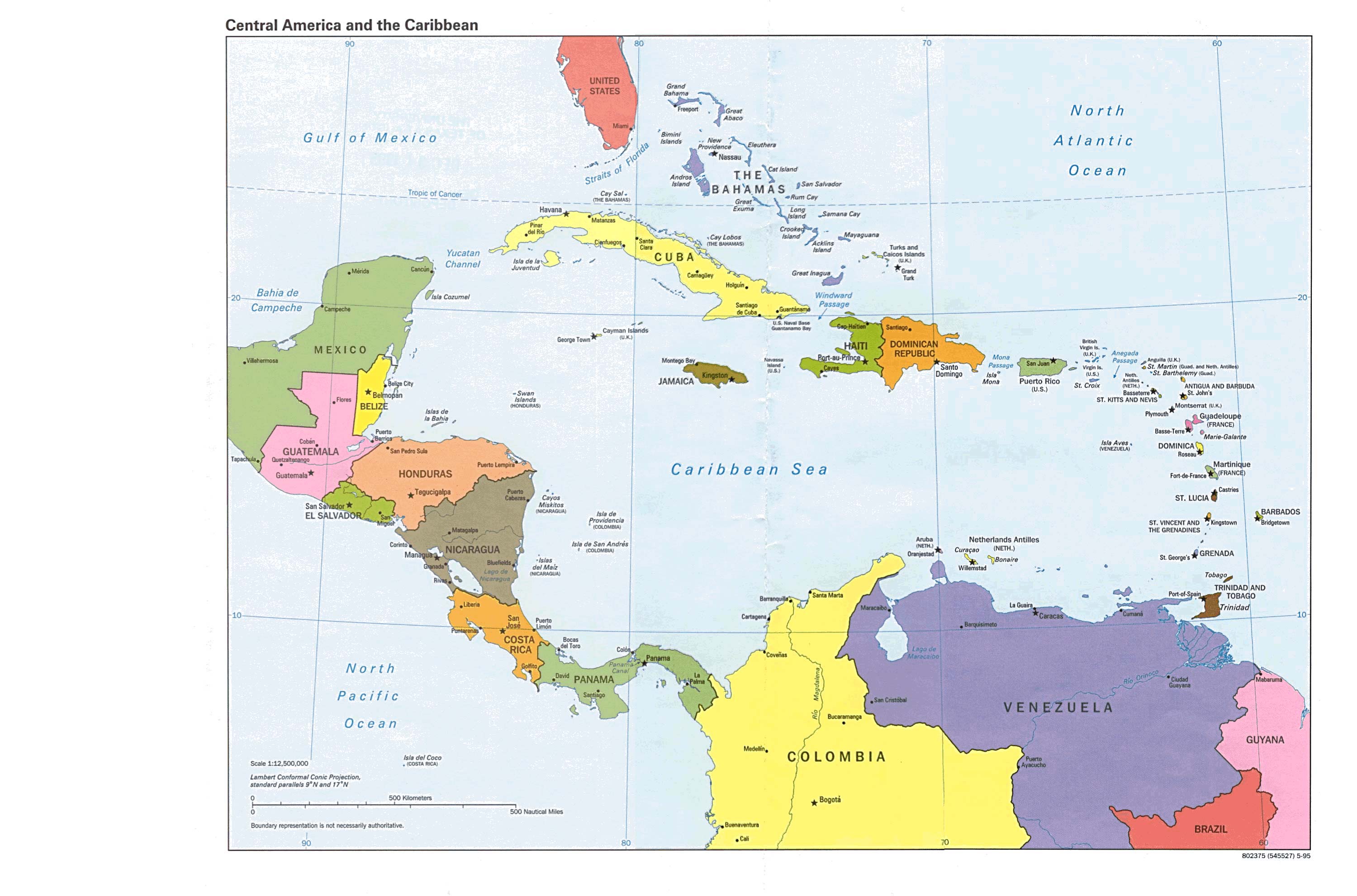